Fig. 1

Download original image
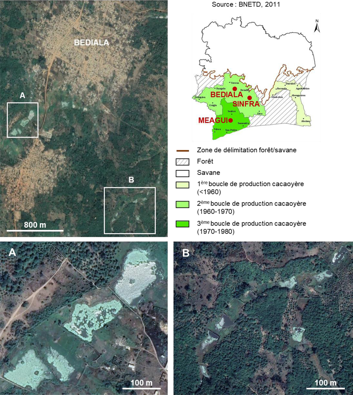
Carte des trois régions d’étude et occupation des bas-fonds par les étangs piscicoles dans la localité de Bédiala. Les cultures en bordure d’étang sont visibles sur les images satellites (Google Earth ®).
Map of the three study regions and occupation of lowlands by fish ponds in the locality of Bédiala. Cacao fields on the edges of ponds are visible on satellite images (Google Earth ®).
Current usage metrics show cumulative count of Article Views (full-text article views including HTML views, PDF and ePub downloads, according to the available data) and Abstracts Views on Vision4Press platform.
Data correspond to usage on the plateform after 2015. The current usage metrics is available 48-96 hours after online publication and is updated daily on week days.
Initial download of the metrics may take a while.


